Weather warnings extended with snow forecast across weekend
A further weather warning has been issued with snow and ice forecast from Friday morning through until Sunday evening.
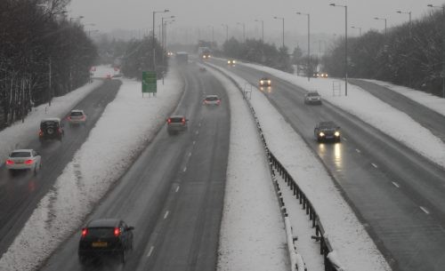
Earlier this week a yellow weather warning for snow in the Wrexham area and large parts of the UK had been issued by the Met Office. This remains in place between 12:05am on Friday morning until 6pm on Saturday evening.
Temperatures overnight are set to drop to zero, with highs of just 2C tomorrow. However the Met Office say temperatures will feel as though they are in minus figures.
The Met Office states that while the worst of the snowfall will affect parts of Scotland, Northern Ireland and northern England, 10-20cm is possible in some locations. This includes
northern Scotland, Northern Ireland, north Wales and perhaps the northwest Midlands.
The Chief Forecaster’s assessment adds: “During winter weather which brings snow showers, it is not uncommon for snow amounts to vary considerably across short distances. On Friday and Saturday, the snow showers could lead to snow accumulations which vary markedly across the warning area.”
Icy surfaces are also likely to be an additional hazard, especially overnight.
A weather warning for heavy snow has now also been issued between 4am and 11:55pm on Sunday, with the Met Office stating: “A spell of heavy snow is possible over some central parts of the UK during Sunday.
“This could lead to road, rail and air travel delays, with the potential for vehicles to become stranded or public transport to be cancelled. Rural communities with limited access routes could become cut off.”
Wrexham and north Wales are also included in this weather warning, with temperatures again forecast to drop to zero.
Of course if snow does hit the area, you can follow our updates here on Wrexham.com or over on our Twitter @wrexham!
Spotted something? Got a story? Email [email protected]