
Five areas in Wrexham identified as being at “higher risk of flooding” in new plan
An updated report on how the local authority will deal with flooding across the county borough during storms will be debated by councillors this week.
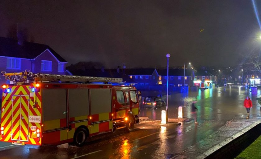
The document has been created following criticism of the local authority’s response to Storm Christoph in January 2021.
A day of torrential rain caused flash flooding and widespread disruption throughout the county borough.
Several areas were badly impacted the storm, with homes evacuated in New Broughton, Bangor-on-Dee and Almere Farm, near Holt. Parts of Rossett and the Ceiriog Valley were also hit by flooding – with the heavy rainfall also causing a landslide in Newbridge.
18 months later the road has yet to be repaired.
The local authority was criticised at the time for its response, which was seen by some councillors as slow.
Wrexham Council was later asked to improve its work after it was agreed that communication problems were partly to blame for a slow recognition to the seriousness of Storm Christoph.
On Wednesday a report on the lessons learned from last January’s storm and an updated Flood Risk Management Plan (FRMP) will be debated by members of the council’s homes and environment scrutiny committee.
The plan, which can be viewed in full here, sets out the areas most at risk of flooding in the county borough and the work the local authority will carry out over the next six years to “mitigate these risks and make our communities more resilient”.
It notes that there is “some level of surface water flood risk to all communities in Wrexham”.
However there are five areas in the county borough seen as a higher risk of both surface water or fluvial flooding (caused when rivers, lakes and streams overflow) – Acton, Caia Park, Cefn, Offa and Rhosddu.
A higher risk community area is described as being “any area in which there is a combined (sum of both surface water and fluvial) risk of 30 or more properties at a 1 in 100 year risk of internal flooding. This equates to 50% of the properties perimeter experiencing a depth of surface water flooding in excess of 200mm during a 1 in 100 (1%) event, or experiencing greater than 200mm fluvial flood depth during a 1 in 100 (1%) event.”
In Acton flood risk maps show that around five per cent of properties are at risk of internal surface water flooding.
The report highlights how the heavily urbanised area has “limited areas of significant open space to minimise the impact of higher intensity rainfall events that will inevitably increase the likelihood of surface water flooding.”
Similar comments are made for Rhosddu, where six per cent of properties are at risk of surface level flooding.
In both instances the report states that “with climate change expected to bring increased occurrence of intense, shorter duration rainfall, existing drainage systems will be put under increased pressure, with an expected increase in the occurrence of surface water flooding within the community.”
In Offa there are four per cent of properties at risk from both internal surface water and fluvial water flooding, with the River Gwenfro described as being the main source of fluvial flooding.
Nine per cent of properties in the Cefn area are at risk from internal and fluvial flooding, with the urbanised areas to the south and east most at risk of both types of flooding.
In Caia Park five per cent of properties are at risk of both types of flooding, which would affect both residential and commercial properties in the area.
In terms of surface water flooding the updated report states that “the area is heavily urbanised, with a history of surface waters systems struggling to cope with intense rainfall events (e.g. Deva Way, Queensway). This is exacerbated by a number of unnamed culverted ordinary watercourses in a poor state or repair leading.”
Fluvial flood risk is generally associated with the Afon Gwenfro that “transects the southern portion of the community. Historically there have been a number of issues associated with capacity and blockage of this system that has resulted in flooding to both residential and commercial properties within Caia Park.”
The report also sets out how communication has been improved since January 2021, with a Bad Weather Response Team introduced where “in the event of of a bad weather forecast or a period of prolonged adverse weather; an internal response team is stood up”.
During such incidents the team provided “24 hour coverage” and responded to various storm related queries.
One of the criticisms during Storm Christoph was the difficulty some councillors had in reaching the relevant officer or member of council staff.
The report stated during the three named storms this year a “dedicated landline was made available to councillors, providing them with the means of exchanging information without delay”.
There have been three occasions where this response has been used – Storms Dudley, Eunice and Franklin.
Details are also provided of the council’s cyclic maintenance programme of its 35,000 gullies in the county borough.
The report references how over the “last three years a full and co-ordinated programme of cyclic maintenance has been undertaken.”
It also notes that the council has also finished the “installation of a Smart Gully software system.”
The report states: “We have recently finished the installation of a Smart Gully software system along with training, which will process not just the number of gullies, which we cleanse, but the condition of them.
“We will utilise this gully condition information from a full cleansing cycle to produce future programmes of work.
“The risk assessment tables for each community broken down into surface water, fluvial, combined, and sub-divided into storm event conditions, ie 1 in 100 year, 1 in 1000 year etc.
“A dedicated team of officers, using specialised cleansing and jetting equipment systematically visit, community by community; on a rolling programme, working on a priority basis to manage our cyclic maintenance programme.
“Work includes cleansing, condition assessment reports, jetting and the releasing of blockages, along with asset logging and mapping.
“We will do our best to complete a cleanse of all gullies on an annual basis, but the first few months of using our new system has identified a number of gullies and manholes which need further investigation to get them up to full capacity.
“This obviously will have a knock on effect with regards to timelines on our rolling programme.
“Where issues are found such as obstructions, which impact on the efficiency of drainage lines, or we locate hard to service gullies, the gully maintenance crews will, through the use of a tablet on site, report the issue to the flood co-ordinator.”
The report will be considered by members of the homes and environment scrutiny committee on Wednesday 19 October.
Spotted something? Got a story? Email [email protected]