‘Several Centimetres Of Snow’ Warning For Boxing Day
An ‘uncertain’ weather forecast from the Met Office could see a snow hit of ‘several centimetres even at low levels’.
UPDATE 2:30pm: Councillor Bithell, Lead Member for Environment and Public Protection has been in touch to say gritting will be taking place at 4pm and again at half midnight.
The Met Office latest forecast for Wrexham sees sleet starting 6-7pm with ‘Heavy Snow’ from 7-9pm with more sleet 9-10pm. This period of snow has expanded throughout the day and we will update more later.
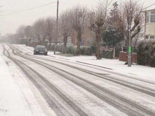
If it does snow, please tweet us @wrexham or email your pictures to [email protected] !
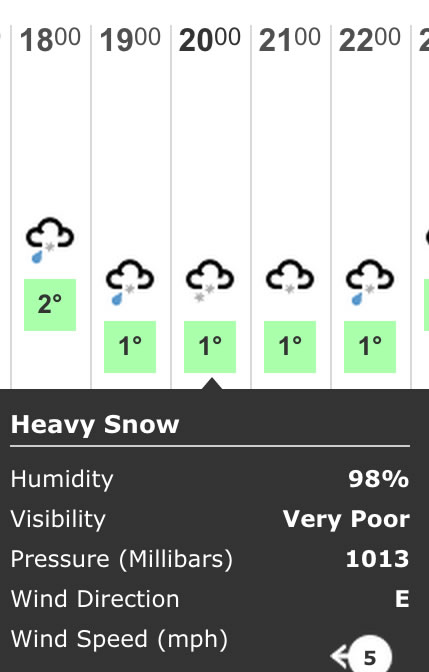
UPDATE Midday Boxing Day: The predictions have changed from chance of sleet around 7pm to some now saying actual snow. The BBC weather page has the most extreme prediction, saying we could have ‘Heavy Snow’ this evening:
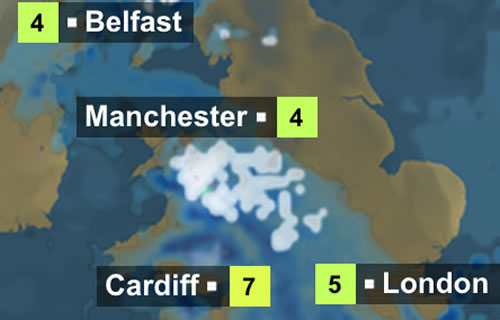
The weather map for this evening currently looks like this, with the snow band being more precise:
Original story below:
The weather warning was issued on Christmas Day and is valid from 11am from today, Boxing Day, through to tomorrow.
The official warning area reads as follows, and affects areas marked on the map below, “An area of rain, sleet and snow is expected to spread eastwards across parts of Northern Ireland, England and Wales during Boxing Day before clearing during the evening and overnight.
“A lot of uncertainty surrounds how much snow will occur, but there is the risk of several centimetres even at low levels. As precipitation clears, roads could turn very icy.
“The public should be aware of the potential for disruption from snow. Please watch for updates to this warning. especially if travelling.”
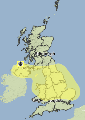
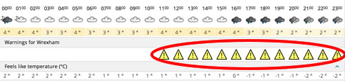
Wrexham is under a weather warning from 11am:
The Chief Forecaster says: “A depression developing over the Atlantic Ocean is expected to track east then southeastwards across the southern half of Britain during Boxing Day. A spell of snow is likely, even to lower levels, on the northern flank of this depression. South of the depression centre, rain will fall, heavy at times.”
“There remains much more uncertainty than average regarding the track of this depression which in turn leads to uncertainty about the location of the heaviest precipitation and how much snow there will be. Where snow does occur accumulations of 2 to 4 cm are likely even to lower levels and in excess of 10 cm possible.”
As always if (or when!) snowfall occurs, tweet/email/facebook/call/pigeon us with your pictures and updates for our usual collation of information!
Spotted something? Got a story? Email [email protected]