Map Merge Site Gives Historic Insight To Town
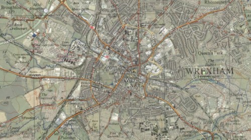
Wrexham.com has been shown the excellent National Library of Scotland mapping system, which allows a ‘google maps’ style view of historic maps overlaid on modern information.
Rather than the normal viewing of old maps, these are specially geo-referenced. This means the maps are presented in a layer, then another layer is placed on top but both layers correspond to the same geographical point.
A slider in the top left allows you to flick back and too between old maps and new – or pause between maps as we did in the screen shot above. This allows you to get your bearings much easier , and also see which parts of the town have change – and which have not!
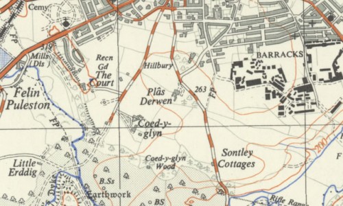
An older view of Hightown and Coed Y Glyn
Maps that are cover Wrexham include:
Great Britain ‘Bartholomew Half Inch’ from 1897
1920’s 1:1m
1937-61 1:25000 OS Maps
1955-61 OS One Inch Maps
OS 1945 Map
Ten Mile Planning Maps – 1881 rainfall maps, to more common ones in the 1930’s.
Wider from Wrexham the maps include ones dating back as far as the 1500’s , and as you would expect from the Scottish national library, coverage for Scotland is immense.
Click here to view the maps on the Scottish National Library site.
Tweet us @wrexham , or post in our Wrexham Forums if you spot anything of interest – or to comment on how things have changed over the years!
Spotted something? Got a story? Email [email protected]