Fitness Dataset Gives Heatmap Of Wrexham
A new heatmap of fitness data gives insight to Wrexham’s runners and cyclists.
The information comes from a fitness app called ‘Strava’, which in simple terms logs where people run and bike when they have the software running.
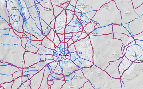
This dataset used to create the global heatmaps includes 77,688,848 rides and 19,660,163 runs representing about 220 billion total data points. This morning we spotted the release, and had a nose at the Wrexham area.
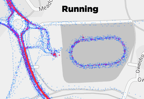
The data shows two traces, or both combined, into an overlay of a Google Map. As an exmaple the below animation we have created shows the trace of people around the Queensway track. This would indicate that people bike to the centre, and run around the track, rather than the other way around:
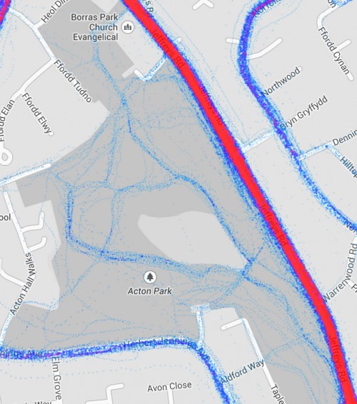
Land usage in and around Wrexham is also revealed, with the common routes inside parks being highlighted:
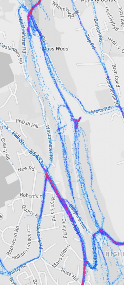
Moss Valley is shown to be a popular route for both biking and running:
There are dangers to such data, as below we have found several points which would indicate where users of the software live despite the data used being anonymised and aggregated. Other hotspots occur in predictable places, Coleg Cambria carparks popular with cyclists, Halfords carpark and specific places on the industrial estate.
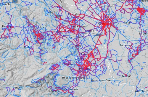
A visual comparison shows that Wrexham is quite ‘warm’ compared to other areas in the region, with certain hotspots such as Llandegla showing up red hot as you would have thought due to the biking centre there:
There is a danger of reliance of the data as it is self selecting of who uses it. It is likely those with a keen interest in fitness, and have the resources to own a compatible device and have the relevant skills to operate and partake in its operation.
The data does though quite accurately map a section of users and gives some interesting insights to the real life usage of the Wrexham environment. One such use could be to create real life biking trail maps around town, targeting bike crime prevention information and perhaps ensuring popular running spots are as safe as possible.
The full global heatmap is here, and we would be interested to know what quirks and interesting bits you find in and around the area, or what useful idea you have from it.
You can email us on [email protected] , post on the Wrexham.com forums, tweet us @wrexham or post on our Facebook Page.
Spotted something? Got a story? Email [email protected]