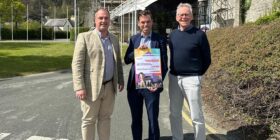
New visitor maps highlighting what the town has to offer are installed
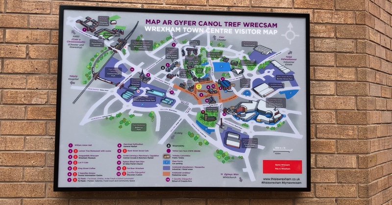
A series of new maps have been installed across the town centre to help highlight what the area has to offer to shoppers and visitors.
The maps, which were funded by the This is Wrexham Partnership, have been designed by local artist David Goodman with the input from local hotels, attractions and eateries.
Located on the likes of Regent Street, Tŷ Pawb and outside the Tourist Information Centre, the maps replace the rather outdated ones that have been in town over the past few years.
Included on the maps are key arrival points to the town at Wrexham General Station, Chester Street (Waterworld) Car Park, King Street Bus Station – along with showcasing some well known and hidden gems, including local eateries, independent shops and Tŷ Pawb.
Chair of the This Is Wrexham Tourism Partnership, Sam Regan said: “These new town centre maps are a great asset for visitors wishing to explore more of our offer here in town.
“Thanks to the financial support from our partner businesses in the area, David has illustrated a map that makes navigating around town and uncovering some of our best places to visit, stay and eat very easy to do.
“As a partnership, we’re also really thankful to the local authority for continuing to work with us to drive tourism forward in town and across the County, via projects such as this.”

Lead Member for the Economy at Wrexham County Borough Council, Terry Evans added: “We’re committed to ensuring that our town centre continues to evolve as a competitive tourism destination and along with the recent investment from ourselves, we’ve been happy to support the ambitions of our local trade by helping erect these new maps around town.
“Whilst many may argue that today’s modern visitor solely uses their mobile devices to navigate a new town, our Tourist Information Centre team are asked for printed maps on a daily basis – and these new designs are a great addition to Wrexham’s marketing material.”
The maps are also available in printed format from the Wrexham Tourist Information Centre and various other attractions and shops around town, including St Giles Parish Church, Wrexham Museum and Techniquest Glyndwr – with a downloadable version and a number of Countywide ideas for days out and weekends away listed at www.thisiswrexham.co.uk/inspireme
Spotted something? Got a story? Email [email protected]