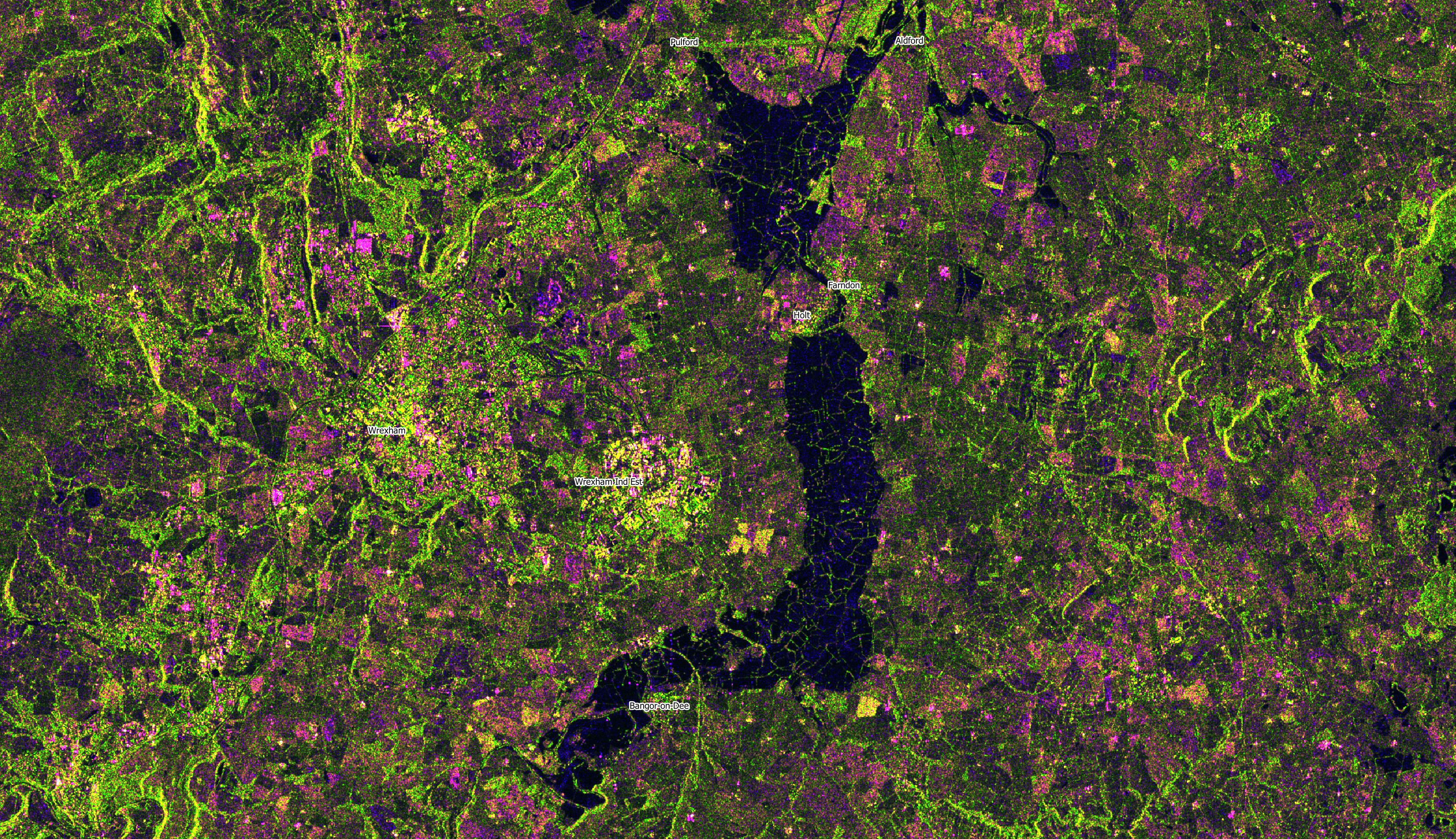
Storm Christoph floods near Wrexham as seen from space
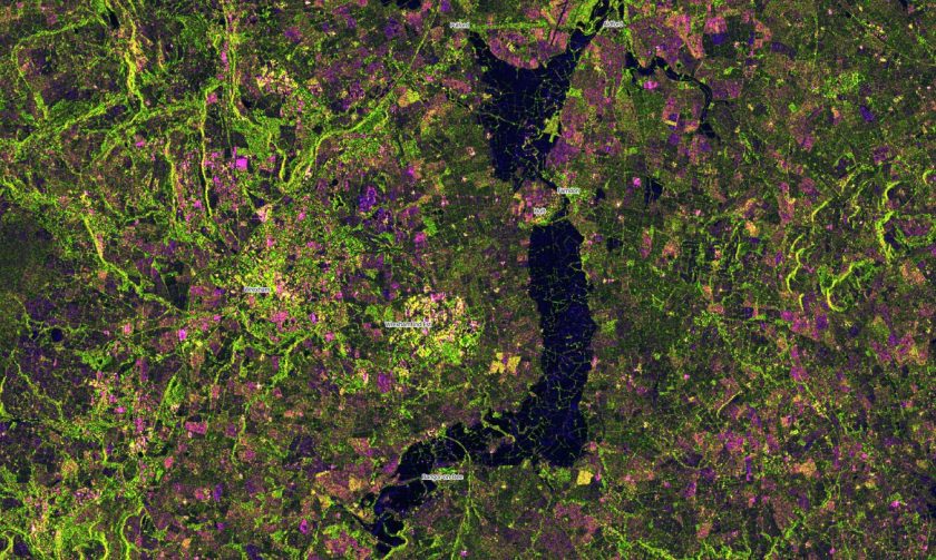
The major floods to the east of Wrexham due to Storm Christoph are clearly visible on new satellite imagery.
Thanks as usual to John Murray, Visiting Professor in the Geographic Data Science Lab at University of Liverpool, who generated these images from satellite radar data using his own Spatia software and kindly provided us with copies.
John explained to us that unlike visible light images, radar sensors can “see” through cloud so are able to monitor the Earth’s surface whatever the weather.
The below is a pseudo-colour image generated from Sentinel 1 radar data showing extent of flooding on Dee Valley – it contains modified Copernicus Sentinel data (2021), processed by ESA, CC BY-SA 3.0 IGO.”
A smaller image is above, however John has provided us with a 2.4 megabyte fuller image, that if you click on the below picture will load allowing a greater zoom level:
Spotted something? Got a story? Email [email protected]