Map With 6bn Tweets Show Tweeting Hotspots For Wrexham & Wales
Six billion geo-tagged tweets have been processed into a map overlay, so we have taken a look at Wrexham via the social media data…
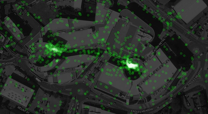
Above is a picture from the map of Eagles Meadow, showing people had tweeted from two defined ends, the left being popular place to grab a shot of St Giles.
The map was created by parsing unique tweets that had location information tagged on them, usually from a mobile phone’s GPS which can be quite scatty and imprecise – but good enough to get a general location picture. Not all tweets are geotagged as often users turn that feature off, similarly some areas simply do not have mobile phone reception so a tweet is not possible.
Below is the view of Wrexham town centre, with hot spots showing at the college, bus station, main shopping streets and supermarkets – specifically the entrance to Tesco. Further out Plas Coch, the hospital and the Racecourse all show quite a light green indicating more tweet frequency:

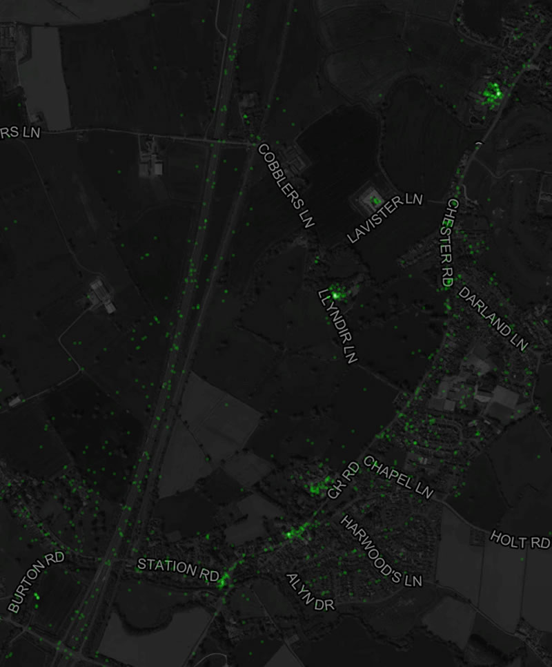
To the north of Wrexham we have taken two snaps, the first showing the general tweet-spots along the linear path of the A483 plus hot spots at the Beeches and the Pant pubs.

Going slightly further north pubs and venues again appear as clusters of tweets, with the Grosvenor being one of the brightest.
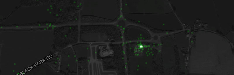
The map shows up the odd hot spot in logical locations, with Chirk McDonalds being one of the brightest green dots to the south of town:
Whereas we were surprised to see the Pontcysyllte aqueduct and area being quite low on usage:

Looking further up the valley Llangollen’s hot spots are as you would expect, with the iconic views of the river and railway being taken from some specific points:

Below is a picture of Wales as a whole, showing the expected population centres alone with the road routes across in England.

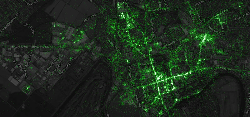
Looking at our near neighbours up the road, Chester’s city centre is green from tourist fuelled tweets, and similar hot spots to us on retail parks, pubs and the like. The station shows as its own cluster to the right.
Each dot is not every single tweet sent due to the lack of geotagging on some, plus processing of the information that has taken place. For example it appears iPhones partially anonymise data opting snapping to linear geodata to avoid revealing people’s exact locations
For those wanting more of a technical explanation to how the data was collected and processed you can read the author’s write up here.
If you like this type of thing, you might like to read this article where Strava data was visualised for Wrexham showing where people went for a run!

Spotted something? Got a story? Email [email protected]