Cambridge University archives ‘unlock landscape histories from the air’
A unique collection of aerial photographs will gradually be seen for the first time as Cambridge University digitises a long private archive.
The Cambridge University Collection of Aerial Photography is the result of airborne survey campaigns which were started in 1947 by the pioneering archaeologist JK St Joseph. The collection contains images of obliques and verticals in black and white, colour and infra-red.
The collection contains images locally from the 1940’s right through to 1999. Currently there have been 1500 ‘showcase’ photos released to start with, but with 500,000 in the collection there will be many more locally appearing, with 80,000 thumbnail digital scans of selected images showing online.
Although most of the collection covers the UK there are also several thousand images taken over Ireland (1951-73), NW France (1961, 1973/4), Denmark (1966-70) and The Netherlands (1970-73).
Instructed St Joseph, the Cambridge University borrowed RAF planes and pilots to take photographs until 1965, when it then bought its own Cessna.
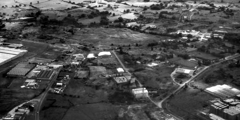
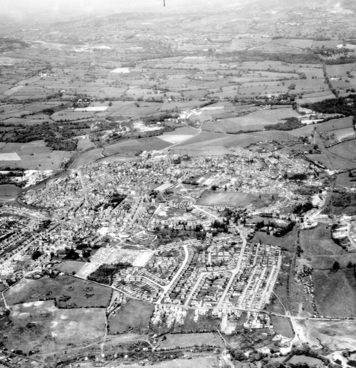
The top image is described as “Derelict Industrial Area, Abenbury” taken in 1979, with the below image being of Overton in 1962.

There are a big range of images locally, however roughly 10% appear uploaded and active. On the interactive map there is a toggle possible to show those with thumbnail images only.
One of the earlier shots is the below of Dinas Bran, taken on the 24th of July 1949 – in the morning.

1960’s Rhos is also covered, along with several other specific sites nearby:
You can delve into the online image trove via the interactive map, and searchable archive on https://www.cambridgeairphotos.com/map/
All images above via the Cambridge University archive.
Spotted something? Got a story? Email [email protected]